WISPR 24MP Mapper Payload
WISPR 24MP Mapper: APS-C Mapping Payload With Integrated Geotagging for the SkyScout 2 Series
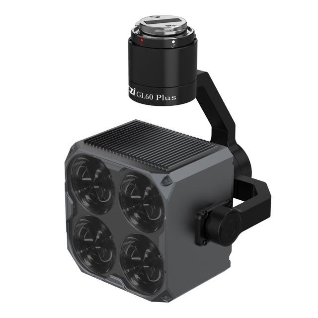
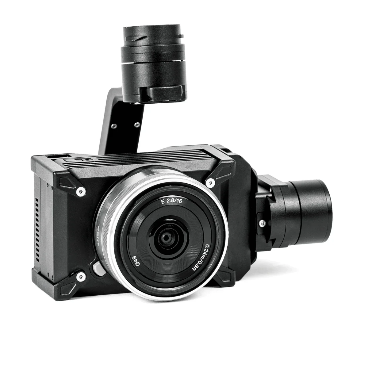
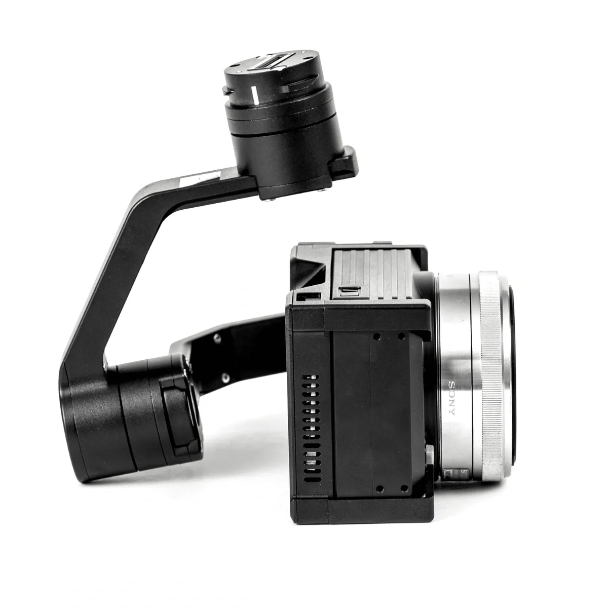
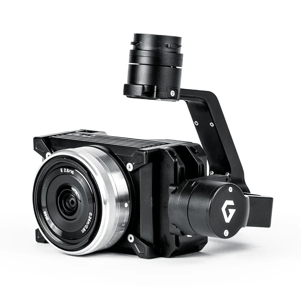
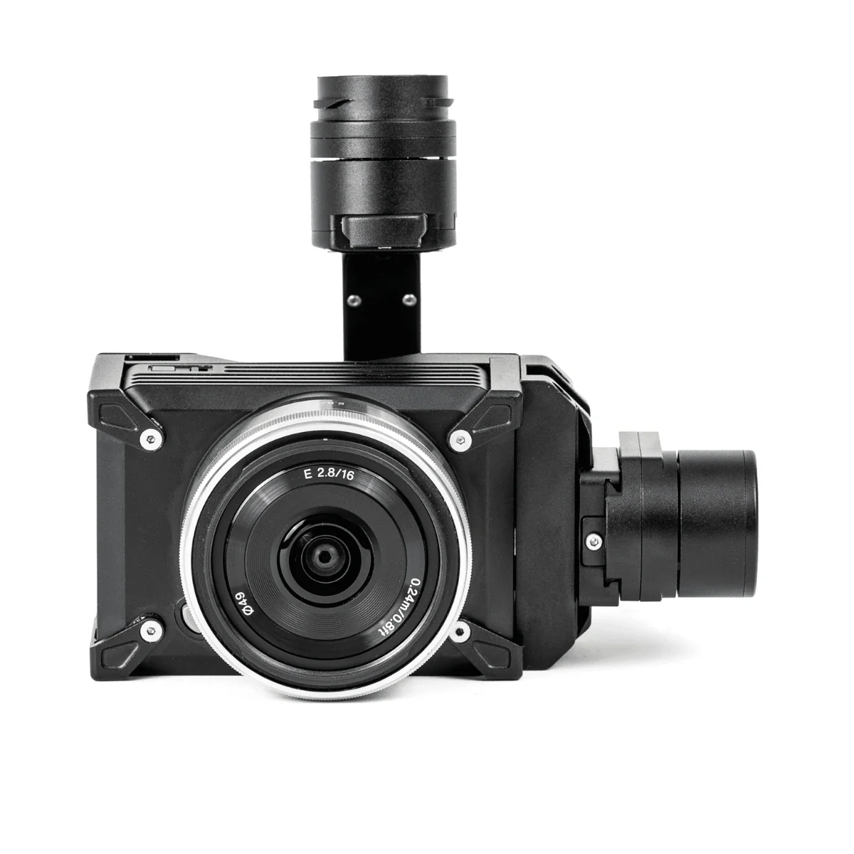
The WISPR 24MP Mapper is a gimbal-mounted imaging payload purpose-built for enterprise aerial data collection on the WISPR SkyScout 2 Series. At its core is a Sony Exmor APS-C CMOS sensor delivering 24-megapixel output at 6000 x 4000 pixels through a Sony E Mount 16mm lens with an 83-degree field of view — a configuration that balances ground resolution with area coverage across mapping, surveying, and photogrammetry deployments. The twist-lock quick-attach gimbal ring integrates directly with the SkyScout 2 payload interface, keeping swap times short and operational continuity intact across multi-payload programs.
For fleet operators and program managers, the 24MP Mapper's data pipeline is as important as its imaging specs. Every image capture writes a full geotag to EXIF — latitude, longitude, altitude, gimbal yaw, pitch, and roll, plus GPS timestamp — while a parallel GPSlog.txt file records horizontal and vertical accuracy values not embedded in EXIF. Video missions generate a frame-accurate subtitle file logging positional data at one data point per second. Shooting in RAW, HEIF, or JPEG, with ISO expandable to 51200 via MFNR and a mechanical shutter range of 1/4000 to 30 seconds, the payload adapts to the lighting and output conditions your workflows demand.
Mission-Ready Capabilities of the WISPR 24MP Mapper
- APS-C CMOS sensor: 1.11-inch Sony Exmor delivers enterprise-grade aerial image quality.
- Full-resolution output: 6000 x 4000 pixel capture feeds directly into photogrammetry pipelines.
- Wide-field lens: 83-degree FOV reduces required passes over large survey areas.
- Stabilized 3-axis gimbal: ±0.02° vibration range keeps imagery sharp through flight dynamics.
- Dual geotagging system: EXIF and GPSlog.txt together capture complete positional datasets.
- Accuracy data backup: horizontal and vertical accuracy logged separately for processing integrity.
- Flexible format support: RAW, HEIF, and JPEG accommodate varied deliverable requirements.
- Video geotag pipeline: subtitle file writes positional data at one data point per second.
- High-ISO capability: sensitivity to 51200 with MFNR extends usability in low-light conditions.
- Integrated mount system: quick-attach ring supports consistent multi-mission payload deployment.
The WISPR 24MP Mapper addresses a persistent gap in enterprise drone programs: a high-resolution imaging payload that produces geospatially complete datasets without additional hardware or post-processing workarounds. The 3-axis gimbal's controlled pan range of ±320° and operating temperature envelope of 32°F to 122°F (0°C to 50°C) support sustained deployment across diverse mission environments and fleet configurations.
Dronefly specializes in building integrated UAV solutions for enterprise operators who need payloads that perform consistently across program-scale deployments. Our team can help you configure the WISPR 24MP Mapper within your SkyScout 2 Series fleet and ensure your data collection workflow is production-ready from day one. Contact Dronefly to get started.
Product Information
Product Information
Shipping & Returns
Shipping & Returns






WISPR 24MP Mapper Payload
WISPR 24MP Mapper Payload
WISPR 24MP Mapper: APS-C Mapping Payload With Integrated Geotagging for the SkyScout 2 Series
The WISPR 24MP Mapper is a gimbal-mounted imaging payload purpose-built for enterprise aerial data collection on the WISPR SkyScout 2 Series. At its core is a Sony Exmor APS-C CMOS sensor delivering 24-megapixel output at 6000 x 4000 pixels through a Sony E Mount 16mm lens with an 83-degree field of view — a configuration that balances ground resolution with area coverage across mapping, surveying, and photogrammetry deployments. The twist-lock quick-attach gimbal ring integrates directly with the SkyScout 2 payload interface, keeping swap times short and operational continuity intact across multi-payload programs.
For fleet operators and program managers, the 24MP Mapper's data pipeline is as important as its imaging specs. Every image capture writes a full geotag to EXIF — latitude, longitude, altitude, gimbal yaw, pitch, and roll, plus GPS timestamp — while a parallel GPSlog.txt file records horizontal and vertical accuracy values not embedded in EXIF. Video missions generate a frame-accurate subtitle file logging positional data at one data point per second. Shooting in RAW, HEIF, or JPEG, with ISO expandable to 51200 via MFNR and a mechanical shutter range of 1/4000 to 30 seconds, the payload adapts to the lighting and output conditions your workflows demand.
Mission-Ready Capabilities of the WISPR 24MP Mapper
- APS-C CMOS sensor: 1.11-inch Sony Exmor delivers enterprise-grade aerial image quality.
- Full-resolution output: 6000 x 4000 pixel capture feeds directly into photogrammetry pipelines.
- Wide-field lens: 83-degree FOV reduces required passes over large survey areas.
- Stabilized 3-axis gimbal: ±0.02° vibration range keeps imagery sharp through flight dynamics.
- Dual geotagging system: EXIF and GPSlog.txt together capture complete positional datasets.
- Accuracy data backup: horizontal and vertical accuracy logged separately for processing integrity.
- Flexible format support: RAW, HEIF, and JPEG accommodate varied deliverable requirements.
- Video geotag pipeline: subtitle file writes positional data at one data point per second.
- High-ISO capability: sensitivity to 51200 with MFNR extends usability in low-light conditions.
- Integrated mount system: quick-attach ring supports consistent multi-mission payload deployment.
The WISPR 24MP Mapper addresses a persistent gap in enterprise drone programs: a high-resolution imaging payload that produces geospatially complete datasets without additional hardware or post-processing workarounds. The 3-axis gimbal's controlled pan range of ±320° and operating temperature envelope of 32°F to 122°F (0°C to 50°C) support sustained deployment across diverse mission environments and fleet configurations.
Dronefly specializes in building integrated UAV solutions for enterprise operators who need payloads that perform consistently across program-scale deployments. Our team can help you configure the WISPR 24MP Mapper within your SkyScout 2 Series fleet and ensure your data collection workflow is production-ready from day one. Contact Dronefly to get started.
Original: $5,500.00
-65%$5,500.00
$1,925.00Product Information
Product Information
Shipping & Returns
Shipping & Returns
Description
WISPR 24MP Mapper: APS-C Mapping Payload With Integrated Geotagging for the SkyScout 2 Series
The WISPR 24MP Mapper is a gimbal-mounted imaging payload purpose-built for enterprise aerial data collection on the WISPR SkyScout 2 Series. At its core is a Sony Exmor APS-C CMOS sensor delivering 24-megapixel output at 6000 x 4000 pixels through a Sony E Mount 16mm lens with an 83-degree field of view — a configuration that balances ground resolution with area coverage across mapping, surveying, and photogrammetry deployments. The twist-lock quick-attach gimbal ring integrates directly with the SkyScout 2 payload interface, keeping swap times short and operational continuity intact across multi-payload programs.
For fleet operators and program managers, the 24MP Mapper's data pipeline is as important as its imaging specs. Every image capture writes a full geotag to EXIF — latitude, longitude, altitude, gimbal yaw, pitch, and roll, plus GPS timestamp — while a parallel GPSlog.txt file records horizontal and vertical accuracy values not embedded in EXIF. Video missions generate a frame-accurate subtitle file logging positional data at one data point per second. Shooting in RAW, HEIF, or JPEG, with ISO expandable to 51200 via MFNR and a mechanical shutter range of 1/4000 to 30 seconds, the payload adapts to the lighting and output conditions your workflows demand.
Mission-Ready Capabilities of the WISPR 24MP Mapper
- APS-C CMOS sensor: 1.11-inch Sony Exmor delivers enterprise-grade aerial image quality.
- Full-resolution output: 6000 x 4000 pixel capture feeds directly into photogrammetry pipelines.
- Wide-field lens: 83-degree FOV reduces required passes over large survey areas.
- Stabilized 3-axis gimbal: ±0.02° vibration range keeps imagery sharp through flight dynamics.
- Dual geotagging system: EXIF and GPSlog.txt together capture complete positional datasets.
- Accuracy data backup: horizontal and vertical accuracy logged separately for processing integrity.
- Flexible format support: RAW, HEIF, and JPEG accommodate varied deliverable requirements.
- Video geotag pipeline: subtitle file writes positional data at one data point per second.
- High-ISO capability: sensitivity to 51200 with MFNR extends usability in low-light conditions.
- Integrated mount system: quick-attach ring supports consistent multi-mission payload deployment.
The WISPR 24MP Mapper addresses a persistent gap in enterprise drone programs: a high-resolution imaging payload that produces geospatially complete datasets without additional hardware or post-processing workarounds. The 3-axis gimbal's controlled pan range of ±320° and operating temperature envelope of 32°F to 122°F (0°C to 50°C) support sustained deployment across diverse mission environments and fleet configurations.
Dronefly specializes in building integrated UAV solutions for enterprise operators who need payloads that perform consistently across program-scale deployments. Our team can help you configure the WISPR 24MP Mapper within your SkyScout 2 Series fleet and ensure your data collection workflow is production-ready from day one. Contact Dronefly to get started.