PIX4Dreact
PIX4Dreact: Fast Desktop 2D Mapping For Immediate Situational Awareness
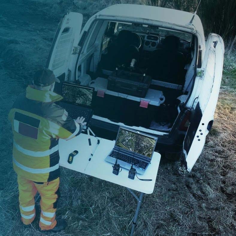
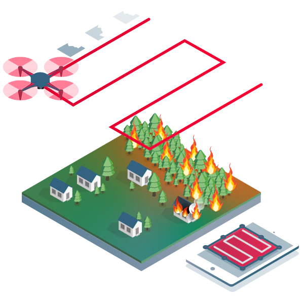
PIX4Dreact is a desktop fast-mapping software designed to transform drone-captured RGB images into accurate 2D orthomosaics within minutes. It is built for operations where rapid mapping and offline capability are critical.
Using a direct-to-orthomosaic photogrammetry technique optimized for mostly flat terrain, PIX4Dreact processes imagery locally on Windows or macOS laptops. By focusing exclusively on fast 2D outputs, it delivers reliable situational awareness significantly faster than full 3D photogrammetry workflows.
Platform Highlights And Fast Mapping Capabilities
- Rapid map generation: create accurate orthomosaics quickly
- Offline workflow: operate without internet connectivity
- Direct orthomosaic engine: optimized for flat terrain scenes
- Desktop processing: maintain full local data control
- RGB-only support: designed for standard drone imagery
- Thermal JPEG visualization: show relative temperature variation
- DSM creation: capture primary ground surface shapes
- WGS84 UTM output: ensure consistent coordinate reference
- PIX4Dcloud sharing: publish maps via web link
PIX4Dreact is engineered to prioritize speed and operational simplicity. Its streamlined 2D workflow allows teams to move from image capture to map production with minimal delay. It provides dependable performance for missions requiring fast geographic context without cloud dependency.
When you purchase PIX4Dreact from Dronefly, you obtain an authorized software license from a trusted UAV dealer with extensive industry experience. We ensure clear licensing guidance and help you align software tools with your drone ecosystem. Buy PIX4Dreact from Dronefly to strengthen your rapid-mapping capability.
Product Information
Product Information
Shipping & Returns
Shipping & Returns

PIX4Dreact
PIX4Dreact
PIX4Dreact: Fast Desktop 2D Mapping For Immediate Situational Awareness
PIX4Dreact is a desktop fast-mapping software designed to transform drone-captured RGB images into accurate 2D orthomosaics within minutes. It is built for operations where rapid mapping and offline capability are critical.
Using a direct-to-orthomosaic photogrammetry technique optimized for mostly flat terrain, PIX4Dreact processes imagery locally on Windows or macOS laptops. By focusing exclusively on fast 2D outputs, it delivers reliable situational awareness significantly faster than full 3D photogrammetry workflows.
Platform Highlights And Fast Mapping Capabilities
- Rapid map generation: create accurate orthomosaics quickly
- Offline workflow: operate without internet connectivity
- Direct orthomosaic engine: optimized for flat terrain scenes
- Desktop processing: maintain full local data control
- RGB-only support: designed for standard drone imagery
- Thermal JPEG visualization: show relative temperature variation
- DSM creation: capture primary ground surface shapes
- WGS84 UTM output: ensure consistent coordinate reference
- PIX4Dcloud sharing: publish maps via web link
PIX4Dreact is engineered to prioritize speed and operational simplicity. Its streamlined 2D workflow allows teams to move from image capture to map production with minimal delay. It provides dependable performance for missions requiring fast geographic context without cloud dependency.
When you purchase PIX4Dreact from Dronefly, you obtain an authorized software license from a trusted UAV dealer with extensive industry experience. We ensure clear licensing guidance and help you align software tools with your drone ecosystem. Buy PIX4Dreact from Dronefly to strengthen your rapid-mapping capability.
Original: $990.00
-65%$990.00
$346.50Product Information
Product Information
Shipping & Returns
Shipping & Returns
Description
PIX4Dreact: Fast Desktop 2D Mapping For Immediate Situational Awareness
PIX4Dreact is a desktop fast-mapping software designed to transform drone-captured RGB images into accurate 2D orthomosaics within minutes. It is built for operations where rapid mapping and offline capability are critical.
Using a direct-to-orthomosaic photogrammetry technique optimized for mostly flat terrain, PIX4Dreact processes imagery locally on Windows or macOS laptops. By focusing exclusively on fast 2D outputs, it delivers reliable situational awareness significantly faster than full 3D photogrammetry workflows.
Platform Highlights And Fast Mapping Capabilities
- Rapid map generation: create accurate orthomosaics quickly
- Offline workflow: operate without internet connectivity
- Direct orthomosaic engine: optimized for flat terrain scenes
- Desktop processing: maintain full local data control
- RGB-only support: designed for standard drone imagery
- Thermal JPEG visualization: show relative temperature variation
- DSM creation: capture primary ground surface shapes
- WGS84 UTM output: ensure consistent coordinate reference
- PIX4Dcloud sharing: publish maps via web link
PIX4Dreact is engineered to prioritize speed and operational simplicity. Its streamlined 2D workflow allows teams to move from image capture to map production with minimal delay. It provides dependable performance for missions requiring fast geographic context without cloud dependency.
When you purchase PIX4Dreact from Dronefly, you obtain an authorized software license from a trusted UAV dealer with extensive industry experience. We ensure clear licensing guidance and help you align software tools with your drone ecosystem. Buy PIX4Dreact from Dronefly to strengthen your rapid-mapping capability.